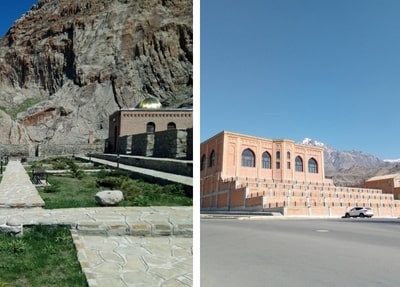
Mount Gemiqaya (Ship Rock) and the petroglyph site represent one of the most remarkable places of Nakhchivan, where, in conjunction with the landscape, traces of prehistoric times are explicitly visible. This is not only a nature trail toward the high plateaus of the Zangzur Mountains but also an open-air archive of thousands of years of rock paintings. Its name is related to the flood legend and Noah’s Ark—the name “Gemiqaya” reflects this belief.
The site is situated NE of the villages of Nasirvaz and Tivi, in the Ordubad district of Nakhchivan Autonomous Republic of Azerbaijan. From Nakhchivan city center, the road continues first to Ordubad and then to the mountain villages, with Nasirvaz being the last settlement. There, the route starts its ascent along the Gilanchay valley and reaches the Garangush plateau, on which the petroglyphs are found, and the slopes of Gemiqaya. The section, particularly this part, requires a vehicle suitable for the terrain, preferably 4×4.
The road from Nakhchivan to Ordubad is asphalted and frequently used. A part of the road from Ordubad to the villages is asphalted, but another part is stabilized. After the village of Nasirvaz, the road becomes a completely mountainous road with narrow curves, steep dirt roads, and rocky parts. It is not safe to drive with a passenger car on this part of the road in rainy or snowy weather. Therefore, it is extremely important to use an off-road vehicle from the moment you enter the mountain road.
The Gemiqaya petroglyphs lie at an altitude of 3,000–3,500 meters. The peak in the same range reaches up to about 3,906 meters. At this height, the weather changes suddenly; during the same day, temperatures can reach 40°C in the valley and be 10–15°C lower on the mountain. During winter, temperatures can drop to -20°C. So no matter what time of the year, you should wear a windproof outer layer, head protection, and waterproof boots.
The best time to visit is late spring and early summer. During this period, meadows open, streams flow, and the risk of mountain road closures decreases. The temperatures rise in the valley in midsummer, and some brief afternoon showers on the mountain may turn rock surfaces slippery. The period between November and April is the usual time when the road may be closed, and for all practical purposes, the area is almost closed to visitors.
Once you have driven up to the threshold of the alpine meadow, the hike to the various groups of petroglyphs is moderately difficult. Because of the high elevation, your pace should be low. The hiking route is rocky, at times steep, and in the 3,000-meter range, where oxygen is in short supply. The distance and length are extended by parking further down; for those susceptible to altitude, the elderly, and families with children, it is advisable to take your vehicle to the highest point possible.
The rock art of Gəmiqaya does not concentrate on one single rock, but several groups have been documented, in particular on the Garangush plateau and on the Gamisholan, Nabiyurdu, and Jamishoglan plateaus. On a short, marked tourist trail, not all stones will be seen. Traveling with a local guide is practically obligatory, thus. The guide will help you quickly locate the petroglyph groups and will assist with any questions you may have at the border.
Most of the drawings come from rocks in the vicinity of a water source and/or a highland path. Distinctive, dense clusters are found northeast from Dali Bulaq and on the Garangush plain. The amount of drawing decreases as the distance from the water source increases. When taking a trip around the site, seeing the springs first and then hillside passes enables access to the rock paintings more systematically.
The status of Gemiqaya as a “historical and artistic reserve” came in the early 2000s. Within this, no writing on the stone surfaces, highlighting of the drawings with paint or chalk, moving the stones, or creating heat with a campfire is allowed. In addition, photography and videography should be done without touching the drawings, forcing the stone, or scratching the surface. You should also follow the instructions of the guide and staff.
It is established through research that the petroglyphs date between the end of the 4th millennium BC and the beginning of the 1st millennium BC. This was a period when animal husbandry and semi-nomadic life in the region were the ways of living. The stones depict goats, deer, bulls, dogs, snakes, birds, panthers, and leopards; hunting scenes, shepherds with flocks, dancing figures, and geometric symbols indicate this species was a primary herd animal.
Some stones depict sun and moon symbols above human figures. It shows that the people of the past depicted cosmic order and belief through a pictorial presentation. In local tradition, the name of the mountain is related to the flood myth, and it is believed that Noah’s Ark landed there. This belief was directly reflected in the name “Gəmiqaya” (which means Ark Rock).
Gəmiqaya site is situated close to the Azerbaijan-Armenia border. Therefore, the visitors need to carry their identification documents while ascending from Ordubad. Group tours ascend the mountain by contacting the local authorities. There isn’t any fixed, public “ticket fee”; the fees paid are for transportation and guide services.
The mountain road is narrow and steep, and for this reason the ascents and descents should be made during daylight hours. It is forbidden to view the military posts or installations in the border area. The cell phone reception can be weak above 3,000 meters; hence, make sure to inform someone in Ordubad or the village about your route, ascent time, and return time. Be careful around flocks and avoid approaching shepherd dogs.
You can leave Nakhchivan early in the morning and, via Ordubad and Nasirvaz, reach the mountain, then come back to the city center on the same day after a 2–3 hour inspection of the petroglyph site. The Gemiqaya program, including transportation and the field trip, takes a full day. A morning visit helps you see the stones clearly before the mountain clouds form, which may happen in the afternoon.
Although dense groups of petroglyphs are close to water sources, the flow of these waters is seasonal. You should bring drinking water. The terrain offers no shade; in the summer, a hat, sunscreen, and UV-protective glasses are obligatory. There are no sale points in the mountain area; you should purchase your food in Ordubad or the village line.
Your most practical options for accommodation are Ordubad or Nakhchivan city center. There are small-scale hotels and guesthouses in Ordubad, and it is easy to ascend early in the morning from there. Traditional adobe houses in Nasirvaz and other villages are not designated for permanent tourist accommodation. If you plan to camp, you must obtain permission in advance due to the border and protected status.
You can get to the alpine meadows by off-road vehicles; natural plains serve as a parking place. In case you have to park your vehicle below, you are supposed to leave it at an open and visible place and notify the villagers. It is not recommended to park right next to the groups of petroglyphs.
The best light for photography of the carvings is in the morning on rock faces facing east and southeast. In those conditions, the sun hits the rocks at an angle that brings out the carvings. The ridgeline towards Garangush gives a view over the Gilanchay Valley and the line continuing to Ordubad in a single frame. When the rocks are photographed from low angle and with oblique light, the depth of the carvings is well brought out in the photo.
Alpine meadows dominate the 3,000-meter band and burst into bloom in early summer. Leopards and predators depicted in petroglyphs testify to the rich historical fauna of the region. Today, flocks of sheep and goats forage on the plateaus; proceed with caution, being mindful of the shepherds’ warnings and not crossing the lines of the herds’ grazing.
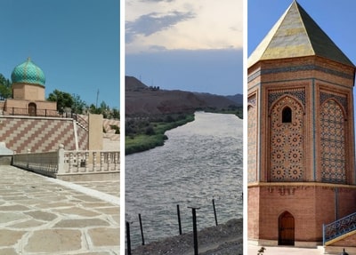
Gəmiqaya is among the most important sites of Nakhchivan, carrying not only its natural beauty but also its prehistoric cultural heritage. You can admire extensive views of the Zəngəzur Mountains from here and read on the stones the traces left by the people of those plateaus thousands of years ago. This route adds both mythological and archaeological depth to your Nakhchivan trip.