Price
From€45
Price

From€45

Booking Form
Enquiry Form
Full Name*
Email Address*
Phone*
Your Enquiry*

* Please select all required fields to proceed to the next step.
Save To Wish List
18155

Ilan Mountain (Snake Mountain)

  • 8 Hours Tour
  • Cable Car Ride
  • lunch
    Tasty Lunch Included

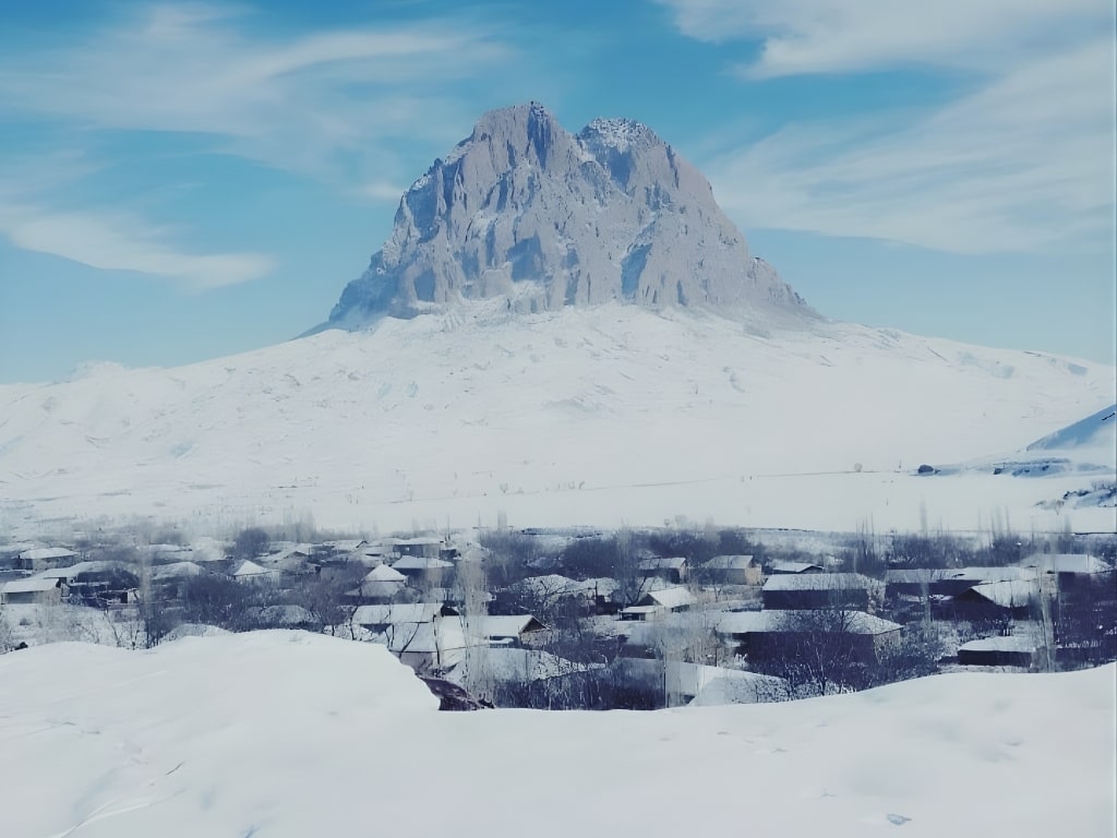
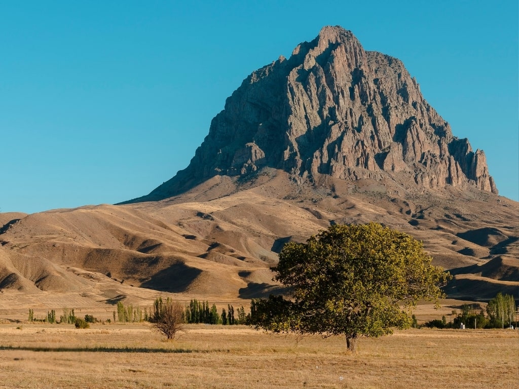
Ilandag or Snake Mountain towers above the village of Gal, Qal in Nakhchivan’s Julfa district. Its summit is 2,416 meters above sea level and rises more than 800 meters above the surrounding steppe, totally transforming the skyline of the region.

The road distance from Nakhchivan city center up to the mountain is approximately 30 km. One can drive from Nakhchivan or Julfa up to Gal village and start climbing it from its upper sections. The leading paved-gravel road is suitable for passenger vehicles up to the village.

Because Ilandag is sufficiently inland in Nakhchivan, no special permissions are required for a standard visit. Provided you have entered Nakhchivan through official channels, you are free to visit the mountain’s area. Note, however, that Julfa’s proximity to the border means you should respect general border rules when photographing military installations.

It is not possible to go further by car than the village, from which point onwards the route shall be completely hiking and climbing. You will have to provide yourself with water, food, and equipment from the very start of the hike because along the route, there are no sale points or regular water sources.

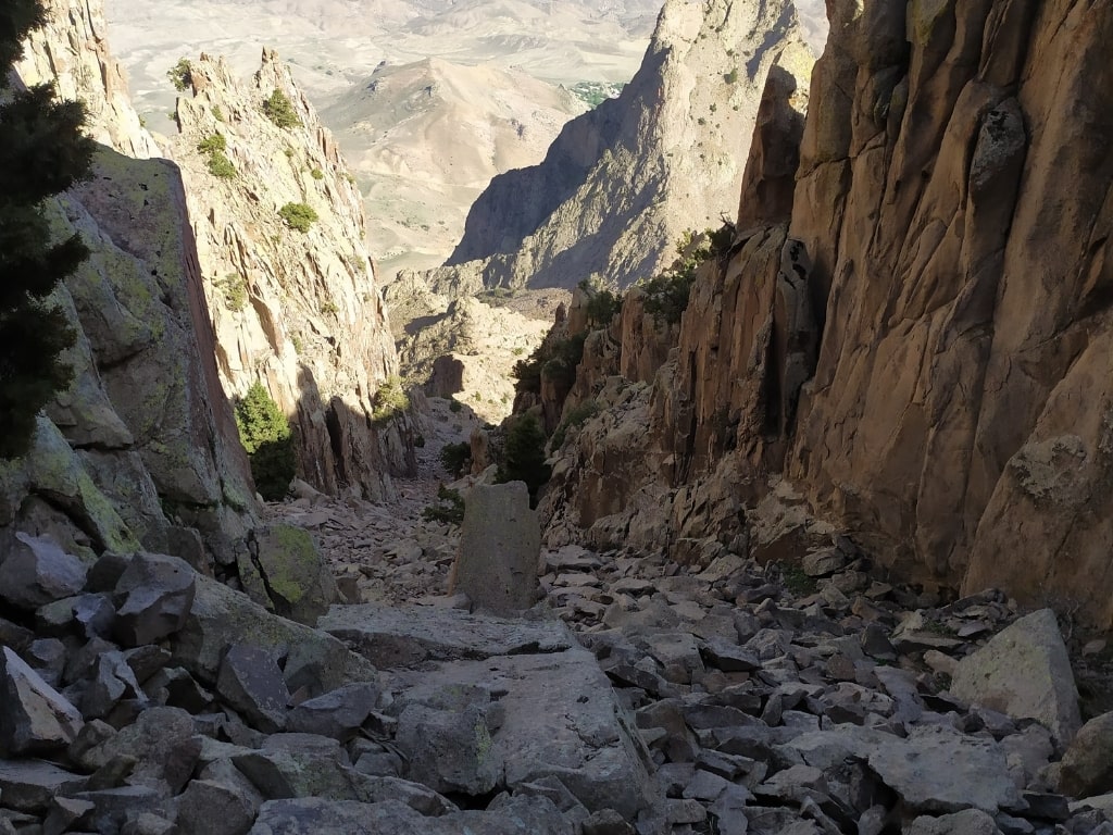
It’s possible to climb to the summit of Ilandag on foot, and tour agencies in Nakhchivan organize day hikes to the mountain. The classic route ascends from Gal village up to the upper ridge and fractured summit line. Alternatively, you can simply view the mountain from the village and its surroundings and take photos.

Generally, the ascent and the descent are scheduled for a single day and take about 10–11 hours. Ascent takes about 6 hours, and the descent takes about 3–4 hours. Since Gal village is situated at an elevation of about 1,230 meters, you gain roughly 1,180 meters in elevation when you reach the summit.

The elevation gain combined with route distance qualifies the route as “difficult.” Those who do not hike regularly as well as children and elderly visitors will find a scenic hike at moderate elevations to be more appropriate than the summit climb.

The best periods to visit Ilandag are at the end of April–early June and September–October. The temperatures at this time are perfect for hiking, visibility is great, and snow and fog are low at higher altitudes. At midsummer, elevations below the peak begin to get warm, while during winter, only ascents with winter equipment and experience should be done due to snow and wind.

Because the mountain rises so rapidly from its surroundings, winds are unusually strong at higher elevations. You’ll feel warm at lower elevations and noticeably cooler at higher elevations all in the same day. There is little shelter around the summit, making a windproof layer, a hat/beanie, and a light raincoat important.

Generally, visitors to Ilandag stay overnight in Nakhchivan city center. It is climbed early in the morning and returned back to the city in the evening after completing the hike. The villages at the foot of the mountain have a poorly developed tourist accommodation infrastructure.

While public transportation lines operate to Julfa and the village, their time of departure is limited and do not often harmonize with the hiking schedule. Therefore, using a taxi, rental car, or tour vehicle is the best practical option. The vehicle would be parked at the starting point of the hike and left there up until the return journey.

The classic route from Gal village is the well-known hiking route in this region. If one stays on the marked or guided trail, it’s safe to hike in daylight hours, appropriately dressed with enough water. It’s good to remember that phone signals weaken at higher altitudes, and to save the route offline beforehand.

Climbing Ilandag is best done with the support of a local guide. As it reaches higher elevations, the trail becomes vaguely visible, sudden changes in weather might pose some risks, and the opportunity to hear some local legends about the mountain will make a guided climb more safe and meaningful. Tour agencies in Nakhchivan work with guides who have experience with the mountain.

The best places for photo opportunities are on the road from Nakhchivan city to Julfa, in open steppe areas, and above Gal village. You can also clearly appreciate the mountain’s side profile from Alinja Castle and the Alinjachay valley. Morning light reveals the split summit form while evening view produces a powerful shadow-silhouette effect.

The name “İlandag” comes from the Azerbaijani Turkish word “ilan = snake,” hence it means “Snake Mountain.” Local legends claim that numerous snakes were seen around the mountain in the past, and that this is where the name comes from.

Another story claims that the old name of the mountain was “Mount of Faith/İnandağ” and that such high peaks took this name in the time of Noah’s Flood. In time, this name became “İlandag” in the folk language. A third story says that Noah’s Ark crashed into the mountain, splitting the peak in two, and that this is why the mountain is also called “Xaçadag/Split Mountain.”

These three legends coexist in Nakhchivan folklore today, imbuing the mountain with strong symbolic significance. You are asked to respect the flag and memorial elements on the summit. By taking this path, you will not only experience a challenging hike in the mountains but also explore this legendary mountain, important to the very identity of Nakhchivan.